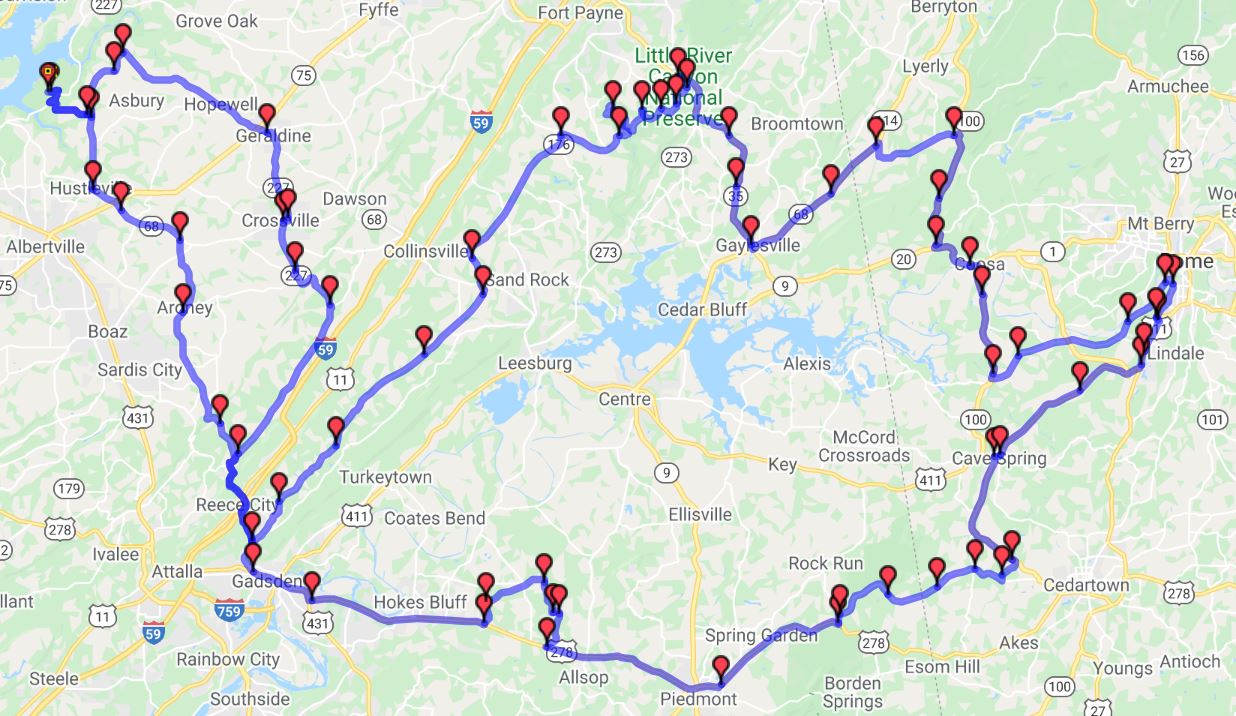
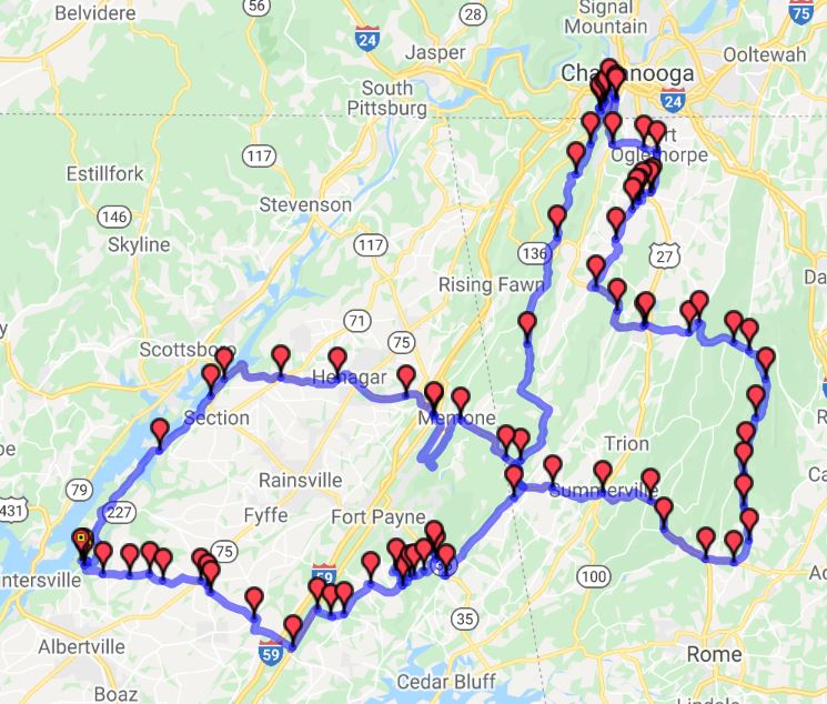
The rider is solely responsible for determining the suitability and safety of these routes based on the rider's skill level, road conditions, and the condition and preparation of the vehicle being operated. COG makes no representations about the route information provided on this page. Some of these routes have not been fully ridden by the rally staff.

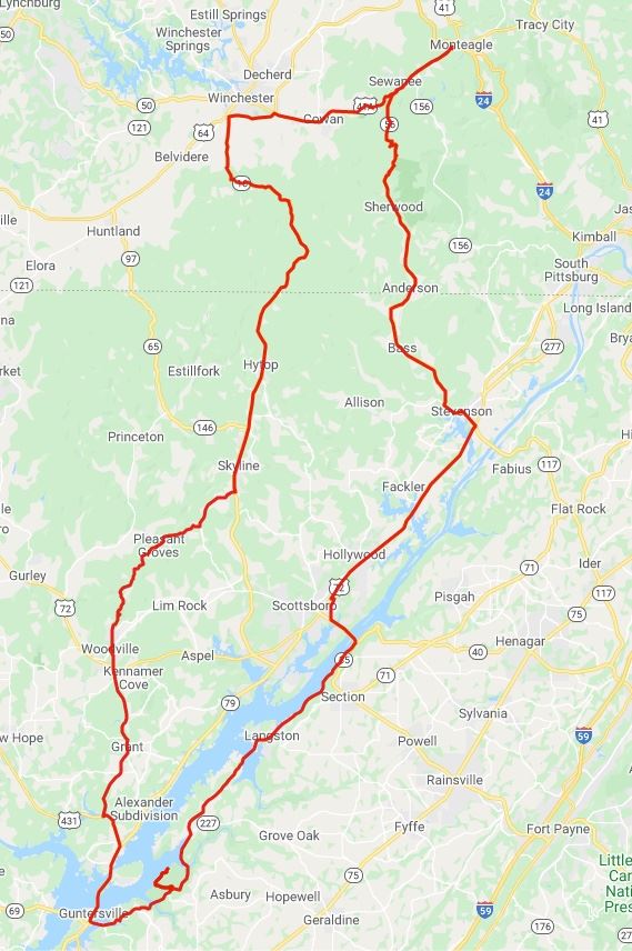
Sewanee, Tennessee

Sewanee Village Business Alliance website

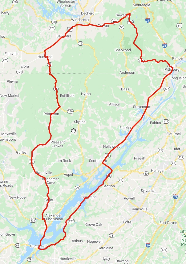
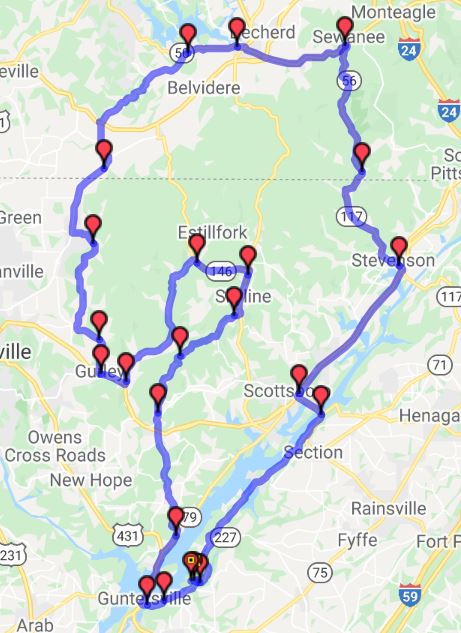
The ride to Sewanee is beautiful in itself and ends on top of the mountain in the town. See the town, shops, and college. SEAD Ron Simmons says it's the best day ride he's found in the area. Some parts are very technical. Pack a lunch and stop to eat in Sewanee or on top of Monteagle Mountain near I-24. You could also consider an RTE to one of the many restaurants in Sewanee or Monteagle.
GPX


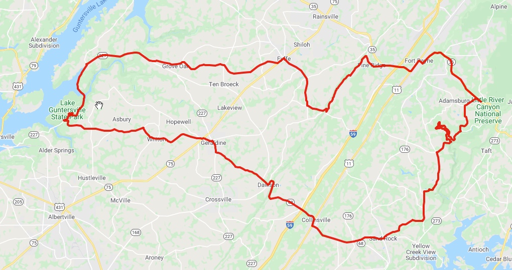
Little River Canyon National Preserve

National Park Service website

Not yet a national park, but close. The rim ride is an intense 10–11 mile collection of twisties with canyon views. Very nice visitor center with free video where you can rest and cool down. Nice place to picnic and take a comfort break.
GPX


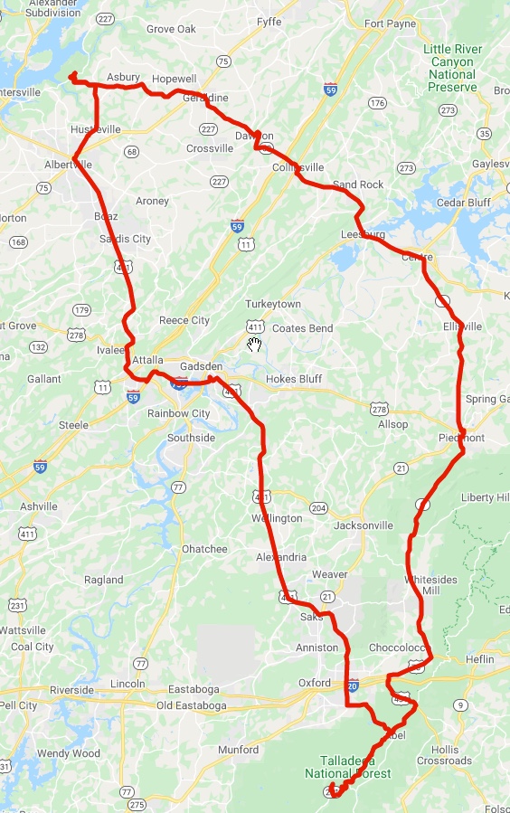
Mt. Cheaha Route

195 miles, 4:28 trip time

Mt. Cheaha is the highest elevation point in Alabama at 2,411 feet. Rolling countryside most of the way until you reach Skyline Drive at Hwy 78, then the fun begins!
GPX

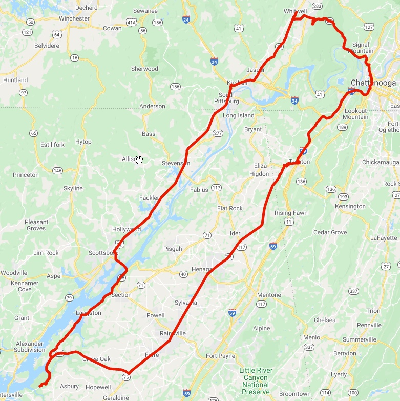
Whitwell, TN

188 miles, 4:00 travel time

Whitwell lies in Sequatchie Valley of southeast Tennessee and is home to a WWII Holocaust Memorial as seen in the film Paper Clips.
GPX


Lake Guntersville Loop

66 miles, 1:25 trip time

The east side of the lake is the most scenic part of the route.

GPX

Southeast Tennessee Loop

182 miles, 4:00 travel time

Recommend taking the western leg first. Excellent countryside and curves, with the option of taking it a bit further north from Sewanee to Monteagle where one can dine at The Smoke House Restaurant. Note that I-24 is not for the faint of heart as it is heavily travelled by freight trucks and involves steep inclines.

GPX

Whiskey Trail

91 miles, 2:14 travel time (one way)

The town of Lynchburg, TN is a quaint little place with a certain well-known production facility.

GPX

Barber Vintage Motosports Museum

84 miles, 1:50 travel time each way

GPX


AL Shamrock Tour Day 1

257 miles, 6:18 travel time

GPX


AL Shamrock Tour Day 3

219 miles, 4:50 travel time

GPX

AL Shamrock Tour Day 4

171 miles, 3:60 travel time

GPX

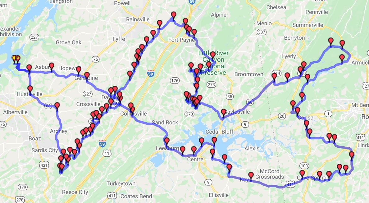
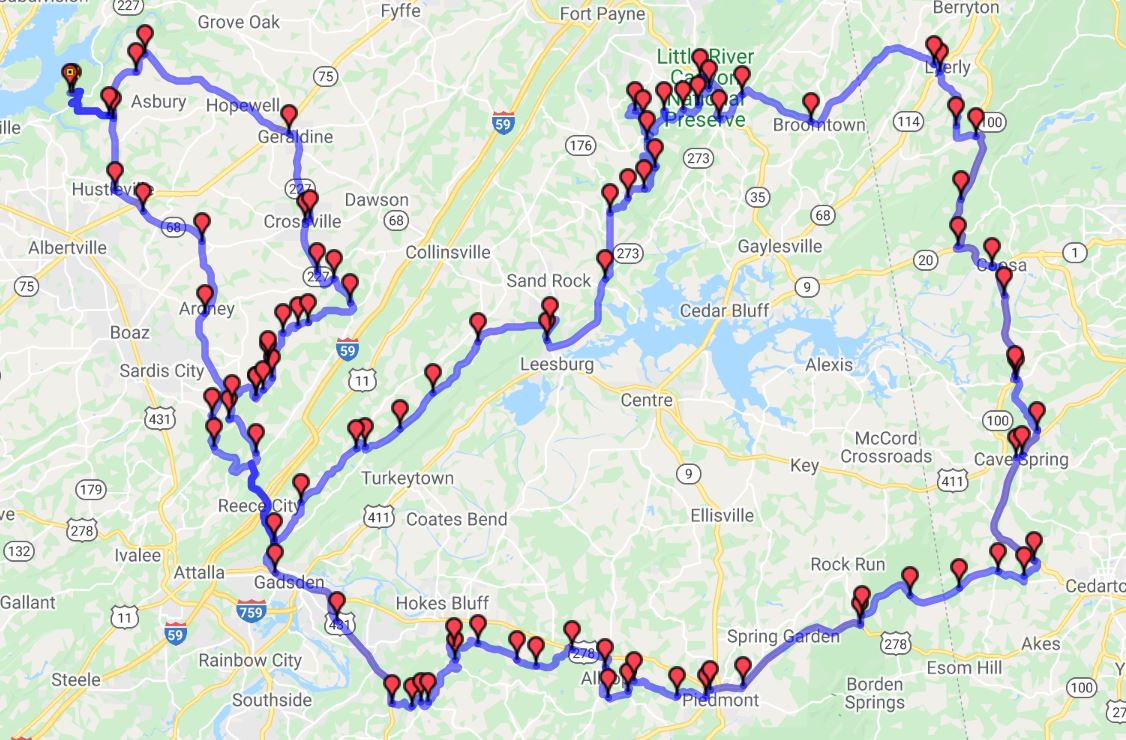
PI Tour #1

253 miles, 6:35 travel time

Whitesboro, Little River Canyon, Coosa (Walmart), Cave Springs, Leesburg

GPX

PI Tour #2

249 miles, 6:32 travel time

Eastern route from National through Little River Canyon National Preserve

GPX

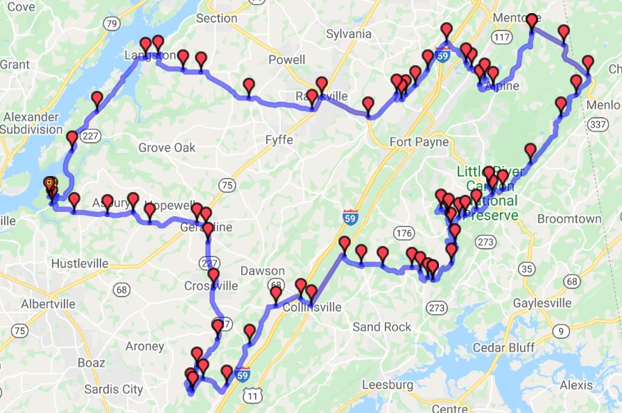
PI Tour #3

157 miles, 4:19 travel time

Shorter Eastern route from National through Little River Canyon National Preserve

GPX

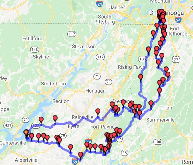
Lookout Mountain

240 miles, 6:25 travel time

Northern Route to Lookout Mountain and Little River Canyon National Preserve

GPX

National to Rome

250 miles, 5:44 travel time

Route to Rome, GA and Little River Canyon National Preserve

GPX


Northeast to Lookout Mountain and Little River

284 miles, 6:47 travel time

Route Little River Canyon National Preserve, Armuchee and Lookout Mountain

GPX

Other resources

For the most part, the riding area lies in the Ridge and Valley region at the lower end of the Appalachian Mountains. The ridges generally run southwest to northeast. Routes that follow that path are generally in the valley or on the ridgetops and can be fairly straight. Most of the higher speed routes and four-lane highways travel in this direction. Going east to west or vice-versa is where the fun begins as you cross the ridges or eventually gain the top of the Cumberland Plateau near Monteagle, TN. 

David Hamil has graciously pulled together this list of websites for your review and use.

https://www.northalabama.org/trails/motorcycle-trail/  

This offers several options for ride destinations. A warning about the Sand Mountain sites. The road leading north from Russell Cave (particularly Orme  Mountain Road) is NOT suitable for Connie riders. It is a dirt track, very rough terrain, and highly rutted.

https://www.bmwmoal.org/routes.php 

Full of suggestions but information is only in GPX or GDB format for your GPS or mapping program. If you don’t have one, you might try GPS Visualizer (https://gpsvisualizer.com)

https://www.motorcycleroads.com/motorcycle-rides-in/tennessee 

Lists routes in northern Alabama as well. Note the continuing mention of Little River Canyon. That area  up to Mentone, AL is a personal favorite. 

https://bit.ly/ScenicALMotorcycleRoute 

Not a route map but a list of excellent locations to explore. I highly recommend all sites that are highlighted on the landing page of this website.

All map data © 2021 Google.

Map interface and GPX file processing: GPS Visualizer